Connecticut Zoning Atlas
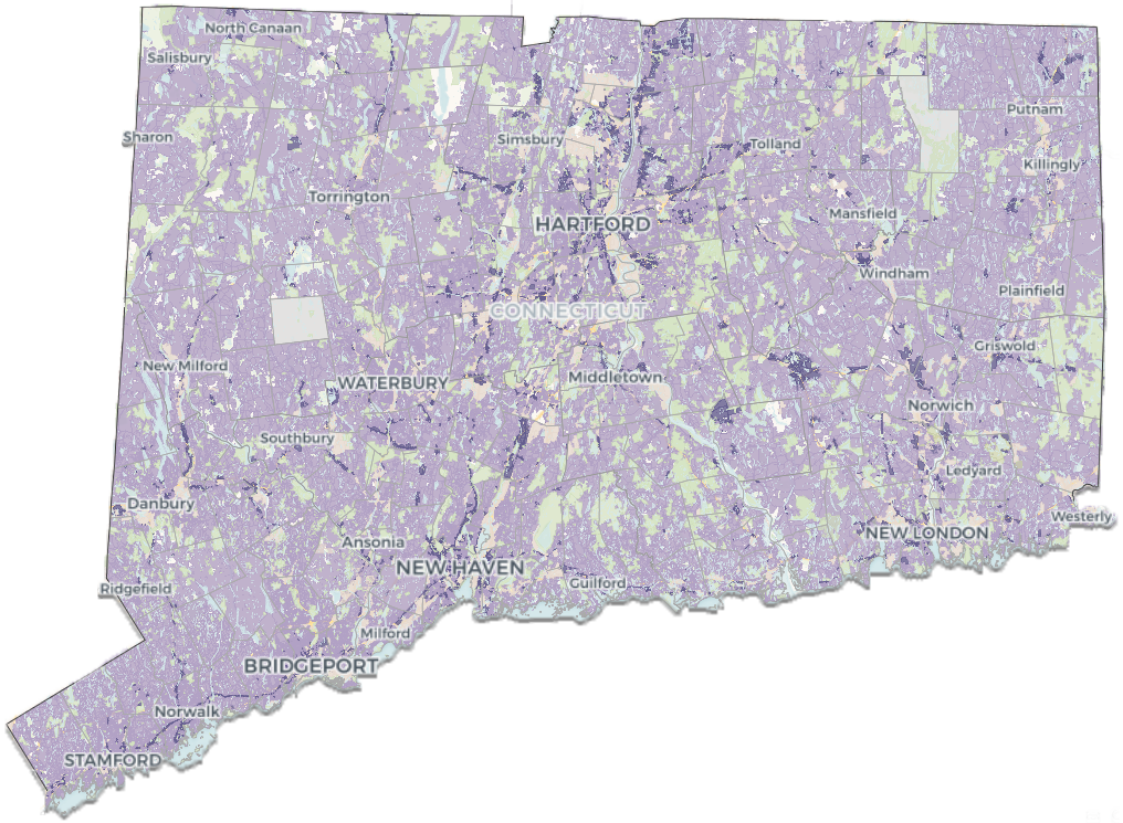
The country’s first statewide zoning atlas was initiated to inform the advocacy and public education efforts of Desegregate Connecticut, a program of the Regional Plan Association. The Connecticut Zoning Atlas, completed in 2021, provided the template for other statewide projects.
-
Connecticut Public Radio, Zoning laws contribute to neighborhood segregation in CT, study finds: Public radio segment highlighting the “Bringing Zoning into Focus” report to explicate the links between single-family zoning and segregation in the state.
Governing, Single-Family Zoning Linked With Income and Race Segregation: Provides an overview of findings from the “Bringing Zoning into Focus” report that studies zoning’s relationship to racial and economic segregation using the Connecticut Zoning Atlas dataset.
Energy News Network, Zoning norms slow efforts to cut transportation pollution in Connecticut: Article highlights findings from the Connecticut Zoning Atlas, emphasizing how the state's local zoning ordinances, which predominantly favor single-family homes, impede efforts to reduce vehicle emissions.
-
Sara C. Bronin, Zoning by a Thousand Cuts, summarizing key findings
Yonah Freemark, Lydia Lo, Sara C. Bronin, Bringing Zoning Into Focus, highlighting correlations between zoning, race, homeownership, income, and more
DesegregateCT issue briefs:
The Environmental Case for Zoning Reform: Using the Atlas to reveal the tendency of Connecticut communities to zone to enforce sprawl and prevent walkable communities, and advocating for a reversal of land use policies causing costly environmental degradation.
Get on Board for Equitable Transit-Oriented Communities: Using the Atlas to show zoning around Connecticut’s train and CTfastrak stations and explaining how they thwart mixed-use, dense neighborhoods round transit.
Small Lots in Smart Places - A Right-Sized Solution for CT: Using the Atlas to explain the current status of minimum lot sizes and the need for reform.
Finally, the following story from PBS NewsHour highlights how the Connecticut Zoning Atlas illuminates how excessive regulation dampens housing production and exacerbates the housing shortage:
-
Director: Sara C. Bronin
NZA Zoning Code Anaylst: Jonah Pellecchia
NZA Geospatial Analyst: Evan Derickson
Geospatial Lead: Ilya Ilyankou of the Connecticut Data Collaborative
Geospatial Map Coordination: Cary Chadwick
2020-2021 Zoning Code Analysis: David Block, Giacomo Cabrera, Sarah Cherfan, Constance Chien, Emma Cotnoir, Josephine Cureton, Taylor Dallin, Sophia De Oliveira, Giuliana Duron, Maxine Faisant, Kevin Fitzgerald, Christopher Gelino, Kathleen Gibbons, Erin Hill, Emily Karr, Jared Klukas, Andrea Lee, Sunnie Liu, Lucia O’Sullivan, Natalia Perez, Emily Tian, Isaiah Wright
2020 Geospatial Map Collection Assistance: David Dickson, Mark Hoover, Quinn Molloy, Emily Wilson
Special Thanks: The Community Foundation of Eastern Connecticut for generous grant funding and the municipal planners of 63 towns, who confirmed data accuracy